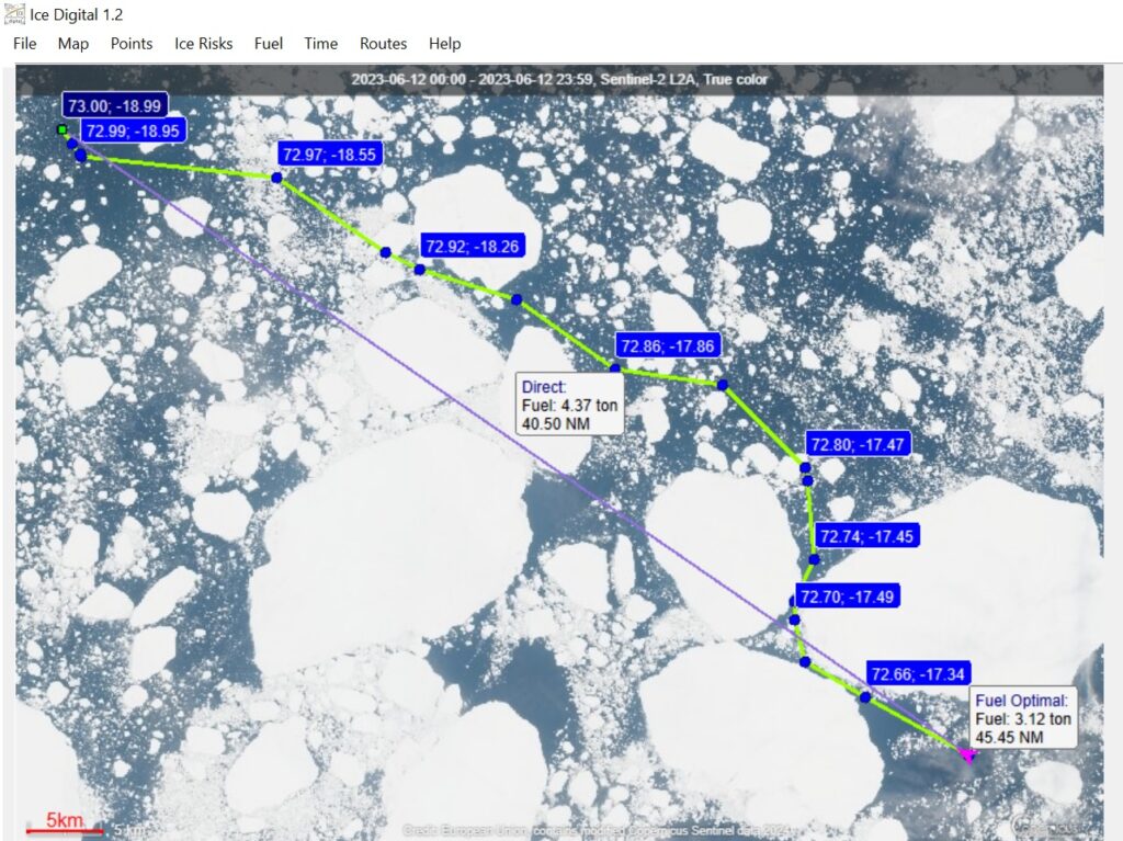
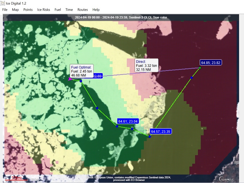
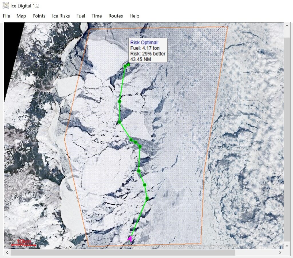
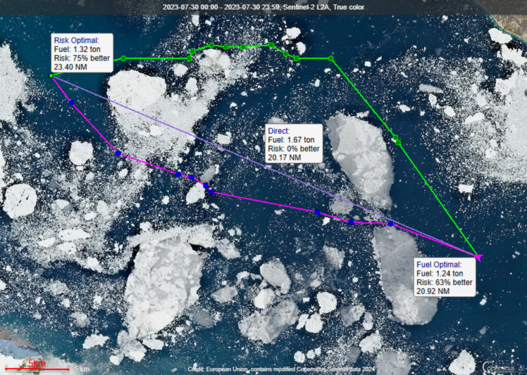
Ice Digital 1.2 Software Find the best route in ice – by fuel, by risk, by time. Find time reachability zones. Export routes. Get more info Smart Route Optimization on Satellite images [Software Screenshot] The Arctic, Greenland Sea: fuel-optimized route versus direct route Key features: High-resolution satellite imagery updated daily Route optimization by consumed fuel in tons per nautical mile Export of optimal route waypoints to a standard TXT format for easy data transfer Calculation and display of isochrone map for your better time planning Direct optimization on actual satellite data, bypassing delayed traditional ice charts Supported vessels Polar cruise vessels and expeditionary yachts Merchant fleet (Cargo, Container ships, and Tankers) Commercial fishing vessels Research, icebreaking, and safety support vessels Target users Ship owners & Fleet managers Marine Operations Centers Ship Masters & Ice Navigators Ice Digital for Education & Research Train the next generation of ice navigators using real-world satellite data Simulate historical ice scenarios for maritime research and risk analysis Model and optimize prospective Arctic and Antarctic logistics systems System requirements Windows 10 / 11 (64-bit)Intel Core i5 processor or equivalent (8th generation or newer)8 GB RAM minimum100 MB of available disk space The Baltic Sea, Gulf of Bothnia: reachability zones for up to 2 hours (green), up to 3 hours (yellow), and over 3 hours (red) The Tatar Strait: route optimization under partial cloud cover Scoresby Sound, Greenland: optimal route options by fuel (magenta) and risk (green) versus direct line (lavender) Commercial €450 3-month license per vessel Educational €229 1-year license per workstation Ideal for short-term ice navigation and seasonal transitsNote: Uses publicly available satellite data (High-resolution daily updates are currently in development) For universities, academies, and labs Text-based coordinate export and JPG map saving for data analysis and reports Book a video meeting for the demonstration of Ice Digital 1.2 Schedule a video meeting